Research
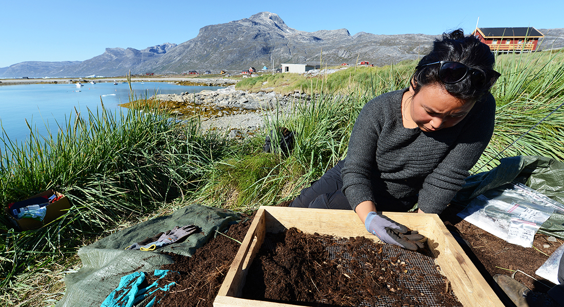
In CENPERM, different scientific disciplines meet as we investigate the biological, geographical and physical effects of permafrost thawing.
We combine field experiments in Greenland, Svalbard, northern Sweden and Russia under extreme conditions with experiments under controlled conditions in our laboratories at University of Copenhagen.
Impact of climate change on soil biogeochemistry
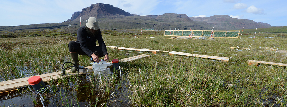
In the Arctic, ecosystems are sensitive to climate change, and changes in the climate can alter the emission of greenhouse gases. Because of the melting of permafrost, organic matter in the soil will start to decompose at a slow but steady rate, and this can lead to emissions of carbon dioxide (CO2) or, under wet and oxygen-poor conditions, methane (CH4). At the same time, dry soils with abundant oxygen can take up atmospheric methane.
CENPERM has investigated the impacts of permafrost melting on these emissions. Series of field experiments with artificial warming of field plots have been set up at different places in the Arctic, and emissions from these plots have been compared with control plots. Samples from Greenland have been studied in the laboratory to determine how different temperatures will affect this decomposition.
videos
Landskabet der prutter (in Danish)
Sammen med studerende og forskere fra Københavns Universitet drager vi på felttur, for at studere, hvad der sker, når permafrosten smelter. Kom med på en spændende tur til Disko i Vestgrønland.
Feltarbejde på Disko, Grønland (in Danish)
Ph.d.-studerende Cecilie Skov Nielsen fra Center for Permafrost laver feltarbejde på Disko, Grønland til sin Ph.d om metanudledning fra arktiske vådområder.
Vegetation changes in the Arctic
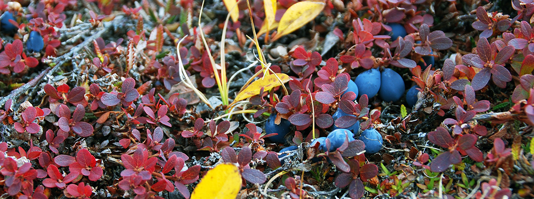
Gradual changes in vegetation composition occur in the Arctic as a consequence of climate change, primarily because of a longer growing season and higher temperatures in the summer months. The most pronounced change in several regions is an increase of abundance and height of vegetation, in particular shrubs, in the tundra.
CENPERM has contributed to inventories of these changes, and has also studies plant composition in experimental treatments in the field, where growth conditions (e.g. temperature or solar insolation) are altered. We investigate also the importance of this growth for ecosystem carbon and nitrogen cycling.
Coastal changes in Greenland
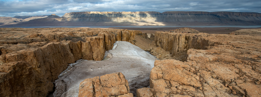
Transport of runoff and meltwater from the Greenlandic ice sheet and from glaciers are important landscape-forming processes and have impacts on transport of nutrients and sediment.
CENPERM has investigated changes in sediment transport and its impact on Greenlandic deltas. Aerial photos and satellite imagery have been used to investigate changes that have taken place over a period of 75 years.
video
Klimaforandringer langs Grønlands sårbare kyst (in Danish)
Verdens kyster er under forandring. I arktiske egne oplever kysten et stort pres som følge af global opvarmning og de største temperaturstigninger ses netop her. Gleschere smelter, havisens udbredelse mindskes og permafrosten tør – hvilken indvirkning har det på de Grønlandske kyster?
Biogenic volatile organic compounds
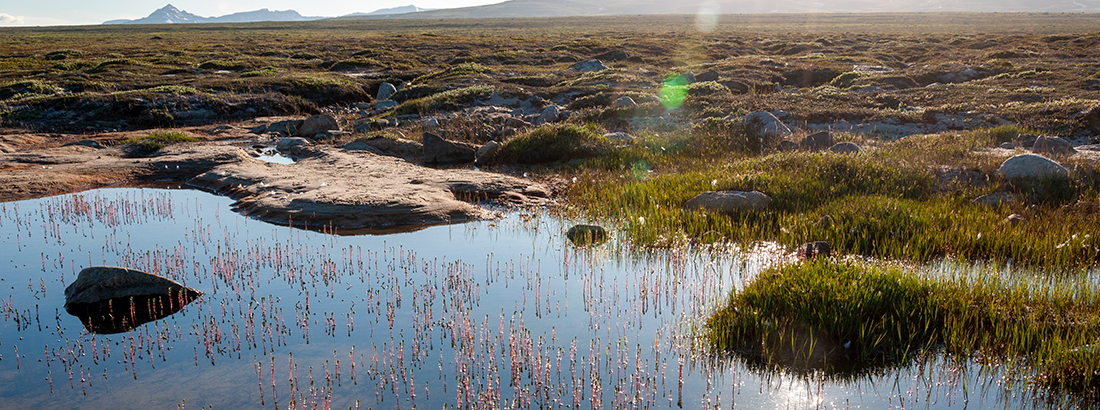
Plants emit a wide range of compounds. Many of these organic compounds are related to plant metabolism, and specific compounds can be related to impacts of stress such as herbivory.
CENPERM has investigated the impacts of future changes on these emissions of organic compounds e.g. by studying the impacts of temperature rise, but also by looking at the plant response to herbivory. Mass spectrometers are used in the lab and in the field to identify and quantify these compounds.
video
Når permafrosten tør – Riikka Rinnan (in Danish)
Tundra wildfires
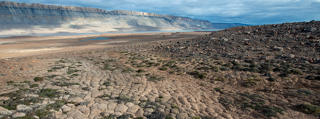
Wildfires are a rare phenomenon in tundra ecosystems, but recently, tundra fires appear to happen more frequently, also in Greenland.
CENPERM has an ongoing experiment investigating the impact of tundra fire on carbon and nitrogen dynamics in the ecosystem. A series of plots at Disko Island, Greenland, have been burnt under controlled conditions, and isotopic tracers have been applied to study the uptake rates of nitrogen in these plots.
In CENPERM’s initial six years (2012-2017), it established research that bridges between molecular studies, ecosystems and landscapes in the Arctic. For the second phase (2017-2021), three themes have been identified:
Theme 1: Ecosystem responses at plot level
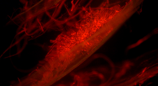
Studies of the interactions between microorganisms, plants and soil at plot level. Continuation of field manipulation studies investigating impacts of long-term climate change, and establishment of new field manipulation experiments with a special focus on extreme events such as warm spells or fires.
Theme 2: Landscape processes and interactions
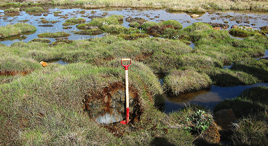
Studies on variations in elemental cycles in the landscape, with a particular focus on the role of permafrost dynamics for transport of water and nutrients and for lateral interactions in the landscape. Monitoring and field experiments along slopes in the Arctic terrain.
Theme 3: Integration and scaling
Studies on large-scale impacts of climate change on permafrost dynamics and its consequences for biogeochemical processes. Use of modelling and remote sensing to integrate the ecosystem and landscape processes for deriving regional impacts.
Arctic Station
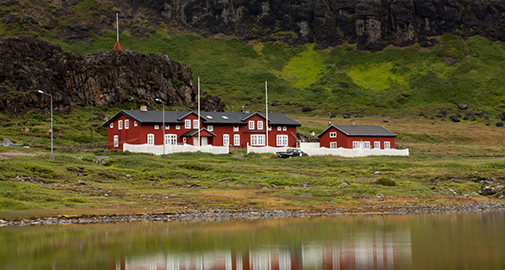
The Arctic Station is located on the south coast of Disko Island in central West Greenland. It is facing the Disko Bay/Davis Strait and is characterized by an Arctic, marine climate. The station offers fantastic scenery with some of the world's largest icebergs drifting by and cliffs abruptly rising to heights of more than 600 meters behind the station. The broad windswpt valley, Blæsedalen, north of the station is home to two CENPERM snow fence experiments established in 20012 and 2013.
The main building with facilities for 26 guests and the laboratory building are located in a nature sanctuary, one km west of the town of Qeqertarsuaq (formerly Godhavn) with about 1100 inhabitants.
The laboratory building comprises three rooms, two of which have standard equipment including electronic balances and microscopes. The third lab is cooled, allowing scientists to work at in situ temperatures. Additionally the laboratory building comprises a darkroom, a room for storage of chemicals, a herbarium, general purpose storage rooms and a library.
The Arctic Station buildings and logistics have been continuously modernized, expanded and developed. Therefore, the station now appears as a state-of-the-art platform for year-round environmental research. The Arctic Station is supervised by a board set up by the Faculty of Science, University of Copenhagen.
Position: 69° 15' N, 53° 34' W.
Brønlundhus
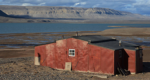
Bøndlundhus Station built as part of the The Danish Peary Land Expedition 1947/48. To day the station is an open museum with many interesting remains from 1947 including the very first Nescafe … Photo credit: Bo Elberling
Brønlundhus Fjord extent 23 km Northwest from the larger Independence Fjord at 82°N and surrounded by up to 800 m high plateaus. Lowlands are dominated by Quaternary deposits from deglaciation 8000 years BP including course fluvial and fine-grained marine sediments. The first observations from the area was made by Freuchen in 1915 reporting the marked marine terraces (strand lines) up to the early Holocene marine limit about 65 m above sea level. But also sand-wedge polygons, solifluction, rock glaciers, beautiful ventifacts are found in the area. The most dominating landscape is the vegetation-free wind-blown polar dessert.
The climate is High Arctic with a relatively warm summer of less than two months and a mean July temperature between 4-6°C. Precipitation is low, poorly described and less than 100 mm per year mostly as snow during winter.
Despite the harsh climate more than 100 vascular plants are known from North Greenland and during the 2014 season more than 62 species were found in the Brønlundhus Fjord area.
The 2014-season included field work from July 19 to August 3 by a CENPERM team including Mathias Madsen, Paul Christiansen, Jørgen Skafte, David Hopkins, Ed Gregorich and Bo Elberling. Activities included setting up a new Meteorological station to provide a water-energy balance, a nitrogen addition experiment with addition of both litter at the surface and as dissolved N near the permafrost table, a slope study, a methane-oxidation study, Salix dendrochronology study as well as a general study of landscape morphology – soil and permafrost characteristics. A detailed permafrost coring programme was completed in 2014. A revisit and sampling is planned in 2016.
Contact: Bo Elberling for any further information
Position: 82° 6’ N, 32° 33’ W
Danmarkshavn
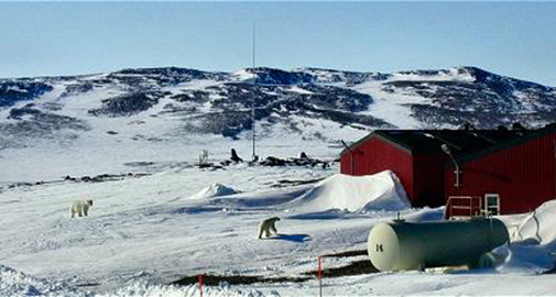
Danmarkshavn is a small weather station located in the High Arctic in the Northeast Greenland National Park, the largest national park in the world. Danmarkshavn is the northernmost location on the east coast of Greenland that non-icebreaking vessels can access. Eight people permanently staff the station.
Position: 76° 46' N, 18° 40’ W
Kangerlussuaq
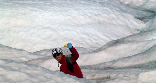
Kangerlussuaq (means Big Fjord; Danish name: Søndre Strømfjord), is a recent settlement located at the inner end of the fjord of the same name. While Inuit hunters certainly visited Kangerlussuaq, there appears never to have been a settlement at the location. It is Greenland's main air transport center with the largest commercial airport. The airport dates from Second World War, when the site was known as Blue West-8. The settlement has a population about 600 who are almost entirely reliant on the airport and tourist industry. Kangerlussuaq International Science Support has easy access as it is located near the main international airport in Greenland.
Kangerlussuaq is at the southern border for continuous permafrost and the landscapes hold great opportunities for studies along different permafrost gradients. Here, the Greenland ice sheet is easily accessible and CENPERM researchers study the surface of the ice sheet (see e.g. the paper in Nature Geoscience by CENPERM scientist Marek Stibal), the proglacial areas, and the main river flowing out of the ice sheet.
Permanent data logging equipment and a climate station have been installed for obtaining relevant data (climate and soil properties). Within the area three sites have been selected based on differences in plant cover, exposure and height. Here, we measure the emission of halogenated volatile compounds.
Position: 67° 01’ N, 50° 41’ W
Narsarsuaq
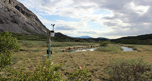
Narsarsuaq (means great plain) is a settlement in southern Greenland with only 160 inhabitants. It was the principal settlement (Brattahlid) for Erik the Red and his son Leif the Happy about 900 AD. During the Second World War USA air force built an air base (Blue West One) for refueling aircrafts bound for Europe. The ruins of a former military hospital can still be found just east of the settlement. In 1958 the airbase were abandoned. Today, Narsarsuaq has an international airport.
At the location, permanent data logging equipment and a climate station collect climatic data and data on soil properties. Within the area three study sites have been selected based on differences in plant cover, exposure and height. Measurements of emission of halogenated volatile compounds are carried over a two years period. In addition, soil samples are taken from the sites for measurements in the laboratory.
Position: 61° 08’ N, 45° 26’ W
Mestersvig
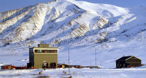
Mestersvig is a military outpost with a runway and a permanent population of two people located 200 km north of Ittoqqortoormiit (formerly Scoresbysund) on the east coast. The runway was originally built to serve nearby mining explorations.
Position: 72° 14’ N, 23° 55’ W
Nuuk Ecological Research Operations
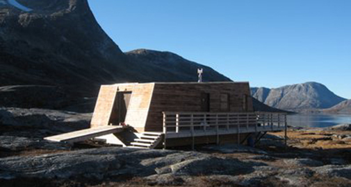
The study site of Nuuk Basic is situated in Kobbefjord in Low Arctic West Greenland, 20 km from Nuuk, the capital of Greenland. Nuuk Basic is an extensive cross-disciplinary ecological monitoring program, which studies the effects of climate change on terrestrial and marine ecosystems. The program was fully implemented in 2008 and will provide long time series of data on the dynamics of a Low Arctic ecosystem.
Focus is on climate change effects and feedbacks in both the marine and the terrestrial compartments of the ecosystem. The drainage basin of 32 square kilometers at the head of Kobbefjord is situated in an alpine landscape with mountains rising up to 1400 meter above sea level and glaciers covering approximately two square kilometers. The terrestrial setting is diverse and includes the most typical vegetation types of a Low Arctic ecosystem within a small area.
A field station with accommodation facilities for four persons at a time supports Nuuk Basic staff and visiting scientists.
Nuuk Basic consists of four sub-programs:
- ClimateBasis, which studies climate and hydrology
- GeoBasis, which studies physical landscape processes including a number of feed-backs to climate change
- BioBasis, which studies biological processes
- MarineBasis, which studies biotic and abiotic processes in the marine compartment of the study area.
The scientific components of the program are coordinated by the Nuuk Basic secretariat at the Department of Bioscience at Aarhus University, Denmark.
Position: 64°07’ N, 51°21' W
www.nuuk-basic.dk
Qaanaaq
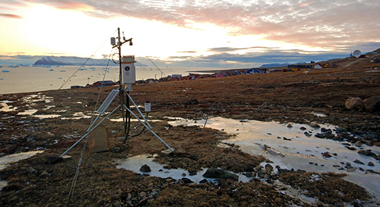
The city of Qaanaaq, located in the far north west of Greenland, is a small isolated town on the shores of the Inglefield Fjord. Its 600 inhabitants are the only ones in Greenland living on sedimentary deposits, making the city susceptible to problems with ground stability and erosion.
These issues led to an extensive scientific study, including several geophysical methods and 26 boreholes, distributed in and around the city, investigating the sedimentary structure to a depth of up to 20m and monitoring the thermal regime since 2017. A field campaign has been conducted on the sloping area east of town, collecting soil and water samples and installing equipment monitoring climate and soil data since 2018. It also hosts a treatment site, where 50m3 of surface near sediment where moved to simulate effects of permafrost thaw and active layer deepening.
Position: 77° 28’ N, 69° 14’ W
Sermilik Station
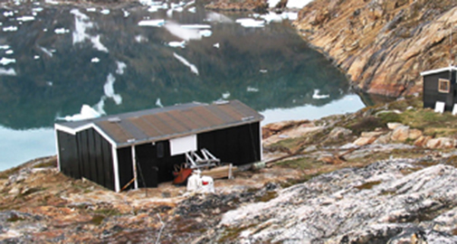
The field station is situated in South East Greenland 20 km west of Tasiilaq – which with its 1900 inhabitants is the most populous town on the east coast. Transport to the station is by charter-helicopter, boat or on foot.
The station consists of a residential building and a depot building. The residential building has three bed- and workrooms with six beds, a kitchen and a living-room. The station was built in 1970, but in 1972 the main building was destroyed by an avalanche. It was later rebuilt at its present location closer to the shore.
The station is not permanently staffed, but during most of the summer researchers will be working here. For security reasons, it is required that at least two people are present at the station at the same time.
Position: 65° 40′ N, 38° 10′ W
Station Nord
The military base of Station Nord in North East Greenland is the most remote location of the Danish Army, only 933 km from the North Pole.
The base is the gateway to northernmost Greenland and plays an invaluable role for both the Danish Army and for science.
It is located in a flat but beautiful area in Kronprins Christian Land. The station is permanently staffed with five persons from the army, even during the four months of darkness. During summer the station can host up to 20 scientists.
The average temperature at Station Nord is -14°C and in February the temperature may reach -50°C. Due to an annual precipitation of less the 100 mm the surrounding landscape is a High Arctic desert.
From 2013 and onwards, the research facilities will be substantially upgraded, thanks to a a major grant to Aarhus University from the Villum Foundation.
Position: 81° 36’ N, 16° 40’ W
Zackenberg Research Station
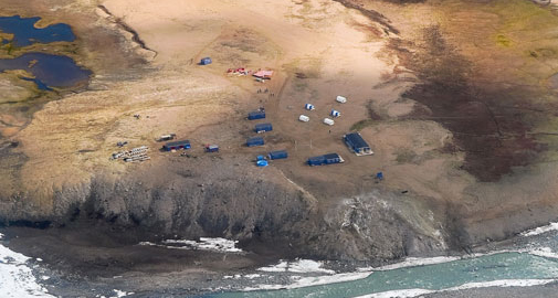
Zackenberg Research Station is located in the high arctic Northeast Greenland, 25 km northwest of the settlement Daneborg - a military outpost with twelve inhabitants. During the brief summer of the high arctic Zackenberg is alive with researchers and logistics staff.
Since its official opening in 1997 the research station has provided accommodation facilities for 25 persons at a time and has several laboratories at disposal for guest scientists.
Zackenberg lies 2 km inland on the south coast of Wollaston Foreland peninsula at Young Sound. The surrounding study area is covered with continuous permafrost with an active layer thickness varying from 20 to 100 cm with the deepest thickness in dry areas.
The margin of the Greenland Ice Sheet is located 60 km to the west of the station. The study area was de-glaciated about 8,000 years ago. Today it holds a great diversity of biotopes like ponds, fens, heaths and grasslands.
The long-term monitoring program Zackenberg Basic has since its establishment in 1995 been the most comprehensive, cross-disciplinary ecosystem monitoring program in the polar regions – the Arctic as well as the Antarctic. It provides access to a wide range of both biotic and abiotic data. Zackenberg Research Station is operated by the Zackenberg Secretariat at the Department of Bioscience, Aarhus University, Denmark.
Position: 74° 28’ N, 20° 34 W
Adventdalen valley
Svalbard
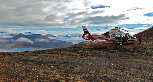
The seven islands of the Svalbard archipelago are located in the Arctic Ocean between 74° to 81° N latitude and 10° to 35° E longitude. The mountainous islands comprise an area of 63.000 km2. 60 % are covered with glaciers, and continious permafrost up to 500 m thick is present in the high-arctic periglacial landscape. Longyearbyen, the main settlement, has 2000 inhabitants and is located at the mouth of Adventdalen valley in the central part of Svalbard. With the University Centre in Svalbard (UNIS), the world’s northernmost institution for higher education, Longyearbyen is a center for Arctic research.
CENPERM researches work mainly in the glacially eroded Adventdalen valley (78°09’-78°14’N, 15°41’-17°02’E), which is 35 km long and 3 km wide. With the river Adventelva it drains westwards into Isfjorden. The mean annual air temperature is approximately -6°C; the average annual precipitation is only 190 mm, making Adventdalen one of the driest parts of Svalbard. The permafrost is the warmest this far north in the Arctic, with ground temperatures from -3˚C to -6˚C.
The Adventdalen valley bottom is covered by fluvial sediments with braided river plains and terraces along the sides. The valley encompasses a highly dynamic landscape with a range of periglacial landforms present: Ice-wedge polygons are widespread and today actively cracking. In addition, rock glaciers, pingos, solifluction and sorted cycles occur. Geologically, the Adventdalen area comprises flat-lying, sedimentary rocks of Early Permian to Eocene age. Coal is being mined from the Tertiary sandstones along the south side of Adventdalen, just as natural erosion and deposition of this coal occurs in the valley.
Strong winds, blowing down valley in Adventdalen from the SE, are dominant in winter and cause a generally shallow snow cover. The influence of the wind on the geomorphological activity in Adventdalen is determined by the regional air flow, not by local conditions.
Position: 78°09’-78°14’N, 15°41’-17°02’E
Ongoing PhD projects at CENPERM
Danielsen, Birgitte Kortegaard:
”Arctic subsurface gas dynamics”. Supervisor: Bo Elberling, co-supervisors Riikka Rinnan and Guy Schurgers.
Hermesdorf, Lena:
"Quantifying the release of nutrients from changing permafrost". Supervisor: Bo Elberling.
Hornum, Mikkel Toft:
"Numerical modelling of periglacial hydrology". Supervisor: Ylva Sjöberg.
Liu, Yijing:
"Snow distribution in Greenland across scales, and its implications for ecosystem processes". Supervisor: Andreas Westergaard-Nielsen, co-supervisor: Birger U. Hansen.
Permin, Aya Foged:
"Moss associated nitrogen fixation in pristine ecosystems: linking activity to bacterial community structure in the light of abiotic controls".
Supervisor: Kathrin Rousk, co-supervisor: Anders Priemé.
Yun, Hanbo:
"Quantifying and modelling methane dynamics in contrasting landscapes of the Qinghai-Tibetan Plateau".
Supervisor: Bo Elberling, co-supervisor: Ludovica D´Imperio Gerogiadis and Wenxin Zhang.
Zastruzny, Sebastian:
"Quantifying the release of nutrients from changing permafrost".
Supervisor: Bo Elberling, co-supervisor: Thomas Ingeman-Nielsen, DTU.
Defended PhD theses
2022
Baggesen, Nanna S.:
"Bidirectional exchange of biogenic volatile organic compounds between subarctic heath tundra and the atmosphere".
Supervisors: Riikka Rinnan and Thomas Holst (Lund University). Defended: Feb. 2022.
Simin, Tihomir:
"Effects of leaf surface temperature and plant traits on volatile organic compound emission from tundra vegetation". Supervisor: Riikka Rinnan. Defended: March 2022.
2021
Pedersen, Emily Pickering:
“Secrets below the surface: Patterns and processes of plant nitrogen uptake in a changing Arctic”.
Supervisors: Anders Michelsen and Bo Elberling. Defended: Sep. 2021
Rasmussen, Laura Helene:
“Nitrate movement in the permafrost landscape affected by snow redistribution”.
Supervisors: Bo Elberling, Per Ambus and Anders Michelsen. Defended: Sep. 2021.
Rieksta, Jolanta:
“Effects of insect herbivory and changing climate on biogenic volatile organic compound emissions in the Arctic”.
Supervisors: Riikka Rinnan and Tao Li. Defended: Sep. 2021.
Xu, Wenyi:
“Nitrogen cycling and greenhouse gas fluxes in Arctic tundra soils - effects of experimentally deepened snow and tundra fire”.
Supervisor: Per Ambus. Defended Nov. 2021.
2020
Fenger-Nielsen, Rasmus:
"Archaeological sites threatened by climate change: a regional perspective from Greenland".
Supervisors: Bo Elberling, Jørgen Hollesen and Aart Kroon. Defended: May 2020.
2018
Cable, Stefanie:
"Holocene landscape history and ground ice distribution in Svalbard and NE-Greenland - Linkages between geomorphology and cryostratigraphy in two mountainous permafrost landscapes". Supervisors: Hanne H. Christiansen and Bo Elberling. Defended: Jan. 2018.
Faucherre, Samuel:
“Permafrost carbon turnover across the Arctic. The role of abiotic sediment characteristics”.
Supervisors: Bo Elberling and Christian Juncher Jørgensen. Defended Jun. 2018.
Karami, Mojtaba:
“Tundra viewed from above. Spatiotemporal patterns of tundra vegetation and its response to climate in Greenland”.
Supervisors: Birger Ulf Hansen and Bo Elberling. Defended Dec. 2018.
Kramshøj, Magnus:
“Biogenic volatile organic compounds in a changing climate - emissions from an Arctic heath and permafrost soil, and uptake by microbes”.
Supervisors: Riikka Rinnan and Christian Nyrop Albers. Defended: Apr. 2018.
2017
Bendixen, Mette:
“Delta dynamics. Evolution of sedimentary coasts in Greenland in a changing climate”.
Supervisors: Aart Kroon and Bo Elberling. Defended: May 2017.
Hauptmann, Aviaja Lyberth:
"Microbial community interactions in Arctic environments using a metagenomics approach". Supervisor: Thomas Sicheritz-Ponten, DTU.Defended Apr. 2017.
Ravn, Nynne R.:
“Carbon dioxide exchange in the Arctic - The effect of a changing climate on soil carbon turnover in tundra heaths".
Supervisors: Anders Michelsen and Bo Elberling. Defended: Aug. 2017.
Schostag, Morten Dencker:
“Living in the cold - Microbial community and function dynamics in Arctic soils at changing temperatures”.
Supervisors: Anders Priemé and Carsten Suhr Jacobsen. Defended: Aug. 2017.
Svendsen, Sarah Hagel:
“Arctic emissions of biogenic volatile organic compounds – from plants, litter and soil".
Supervisor: Riikka Rinnan. Defended: Dec. 2017.
2016
D’Imperio, Ludovica:
"Methane and Root Dynamics in Arctic Soil: Responses to Experimental Summer Warming and Winter Snow Accumulation". Defended: June 2016.
Supervisors: Bo Elberling and Inger Kappel Schmidt.
Lindwall, Frida:
"Emission of Biogenic Volatile Organic Compounds in the Arctic: The Effect of Climate Change", Defended May 2016.
Supervisor: Riikka Rinnan.
Jammet, Mathilde M.:
“Fluxes of Methane and Carbon Dioxide from a Subarctic Lake: Seasonality and Significance within the Landscape”. Defended: December 2016
Supervisor: Thomas Friborg.
Markussen, Thor Nygaard:
“Flocs in focus: How imagery and dynamics of suspended particles unravel land-sea links”. Defended May 2016.
Supervisors: Thorbjørn Joest Andersen and Bo Elberling.
Nielsen, Cecilie Skov:
"Methan Dynamics in an Arctic Wetland: Effects of Vegetation and Climate Manipulations". Defended May 2016
Supervisors: Bo Elberling and Anders Michelsen.
2015
Schollert, Michelle:
"Arctic Vegetation under Climate Change – Biogenic Volatile Organic Compound Emissions and Leaf Anatomy".Defended Jun. 2015.
Supervisor: Riikka Rinnan.
Valolahti, Hanna:
"Impacts of Climate Change Induced Vegetation Responses on BVOC Emissions from Subarctic Heath Ecosystems”. Defended Nov. 2015.
Supervisor: Riikka Rinnan.
Westergaard-Nielsen, Andreas:
"Improvements in Spatiotemporal Ecosystem Monitoring in Greenland: Processes, Methods, and Scales". Defended Mar. 2015.
Supervisor: Birger U. Hansen.
2014
Mikkelsen, Andreas Bech:
“Freshwater discharge and sediment transport to Kangerlussuaq Fjord, West Greenland – processes, modelling and implications”.
Defended Mar. 2014.
Supervisors: Morten Pejrup and Bent Hasholt.
2013
Semenchuk, Philipp R.:
“The influence of snow cover and cold-season temperatures on growing-season processes”. Defended Oct. 2013.
Supervisors: Elisabeth Cooper and Bo Elberling.
Abisko Scientific Research Station
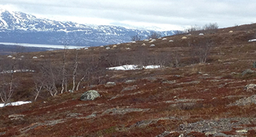
Tree-line heath near Abisko Scientific Research Station in May 2013. In the background a long-term warming experiment with open top chambers, run by CENPERM scientists. (Photo credit: Anders Michelsen).
Abisko Scientific Research Station is located at 68º21’N, 18º49’E in subarctic Northern Sweden, about 200 km north of the Arctic Circle, near the small town Abisko, with a railway station on the railway line between Kiruna and Narvik. The station is open all year with laboratories, offices, workshops, lecture theatres and a meteorological observatory which started in 1913.
The station’s long term records include climate, snow depth, ice thickness and ice duration. Ecological research at Abisko covers the birch forest, mires, mountain heaths, alpine regions, glacier forefields, lakes and rivers. The station hosts a unique set of long-term environmental manipulation experiments, including a range of long-term experiments run by CENPERM scientists, seeking to understand the impacts of increased carbon dioxide concentrations, UV-B radiation, soil temperature, air temperature and snow depth on ecosystems and their processes.
At the Stordalen mire, 10 km east of Abisko, discontinuous permafrost has thawed over the past 30 years. Wetland vegetation is considerably enlarged in extent, and methane emissions have also increased. Exchanges of methane and carbon dioxide between soils and the atmosphere are a concern for future positive feedbacks to the climate system.
Position: 68º 21’N, 18º 49’E
Abisko Scientific Research Station - Swedish polar research secretariat
